Wednesday, August 29, 2007

Thank you Highly qualified HASP personnel !


From the HASP announcement page:


August 28, 2007:
HASP MECHANICAL INTEGRATION: The primary event today was mechanically attaching HASP to the mini-SIP frame and control system. In addition, the mini-SIP was prepared for flight and initial communication tests between HASP and the mini-SIP were successful. Finally, the Hyper-GEOCAM group requested a configuration change to their camera. Highly qualified HASP personnel were able to open the delicate Hyper-GEOCAM payload box and perform the requested change (see daily images).

HASP weather estimates

From Greg Guzik:

Today's weather briefing indicates strong winds building over the weekend and lasting to mid-week next week. Our only near term launch opportunity will be dawn on Saturday, September 1. If we can not make that launch, then the next opportunity may not be until Wednesday or Thursday next week. Thus, we are now planning to complete the compatibility testing on Friday, August 31 and look at launching HASP at dawn on Saturday, September 1.

Tomorrow morning, CSBF will be launching a test of the 37 heavy balloon. You should be able to follow this launch from the CSBF website at http://www.csbf.nasa.gov/ . The scheduled launch time for the 37H is 7:30 am.

Tuesday, August 28, 2007

HASP 2006 on video and HASP 2007 on schedule

Found two videos of the HASP 2006, taken from the CosmoCam a webcam embarked on our HASP flight, enjoy:


The news from HASP 2007:

CURRENT HASP STATUS 13:10 UTC August 27, 2007: Mike Stewart and Greg Guzik have arrived at the flightline in Ft. Sumner, New Mexico. Today will be devoted to locateing all the HASP equipment, unpacking, setting up our control system, and assembling / checking the HASP ballooncraft. So far the weather here has been clear and pleasant, but it is too early to make any reliable predictions about launch
opportunities.

Saturday, August 11, 2007

GeoCam and Hyper-GeoCam are ready to fly.

We passed the qualification and are currently on-board HASP 2007. Stay tuned. Thank you John.

Thursday, June 07, 2007

Integration of our new payloads will take place

in Palestine, TX on July 27th.

Monday, January 01, 2007

The stickiness of panoramic views


Roland Piquepaille did an entry on his blog about us. It is located here and here. It seems to have led to other people noticing this site like the Digital Photography Review. Both entries are leading different types of people to our site. The interesting part of these statistics figures is the stickiness of the panorama site on the two crowds. The ratio between page views and visits is pretty high at about 3.6 to 4.0 according to Google Analytics.

Thursday, December 21, 2006

New Mexican View


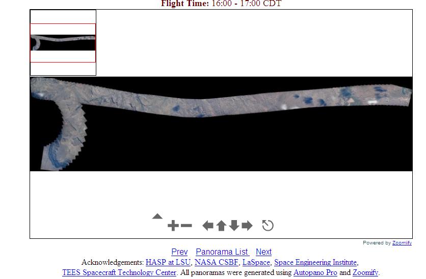
This is what the large panorama looks like. When you create it as a PSB file (Photoshop) using the latest version of Autopano Pro, it is about 51 GB large. It is taking time for us to open it and save it in a format that is viewable on the web (Zoomify).

Hyper-GeoCam


We just sent a proposal to LSU to fly on the second HASP flight with a modification of the current camera. We are now aiming to build a cheap hyperspectral imager.

Orders of Magnitude Resolution Estimation for Digital Cameras at High Altitude

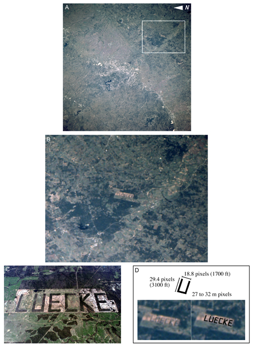
One of the reason for our successful flight is linked to the quality of our photographs. When flying at 36 km altitude, we are roughly at one tenth the altitude of either the International Space Station (ISS) or imaging satellites. For cameras similar to ours, shots taken from the ISS have therefore 10 times less the resolution. Case in point, the LUECKE sign near Bastrop, TX. This sign was used by NASA to evaluate the resolution of astronaut acquired photographs from the ISS.

Calculations show an equivalent of 27 to 32 m for a pixel. The same sign can be seen on Google Maps here. Our previous comparison with Google Maps shows a 1 m resolution for a pixel or imagery details like this one.

Wednesday, December 20, 2006

Sites and Projects we like


* The Global Connection Project: a project with CMU, Google and NASA Ames aimed at using a panorama approach to stiching photos together to produce imagery in case of natural disasters. This is pretty much our approach. They started before us but we just stumbled on their site recently.
* the Multi motif Stratospheric experiment: A team of swedish students who will be performing an experiment similar to ours. But they also have access to a rocket.
* StratoCat: a comprehensive and up-to-date site on high altitude balloons worldwide.
* Post storm imagery from the NOAA. Look out! the whole database of images is about 10 GB.
* Astronaut acquired photographs.
* Another experiment called GeoCam that flew a set of cameras on board the Space Shuttle in 1993.
* NOAA Balloon flights.
* Kite Aerial Photography.
* CU Spaceflight balloons.

Wednesday, December 13, 2006

Off to Louisiana


Some of us will be attending a UAV workshop for disaster monitoring and present a poster of our work doing panoramas. The presentation is available here. We will also send a proposal for the next HASP flight before the end of the week.

Thursday, November 09, 2006

Space Vantage Points


When Nadar went up his balloon 150 years ago and took the first aerial photo, he triggered Jules Vernes into writing "Five weeks in a balloon".
The first panoramic view of a natural disaster was taken one hundred years ago after the 1906 San Francisco Earthquake using a kite.

The first photo taken from space was obtained in 1946, from a V2 rocket and the first panorama in space was taken two years later.

Sixty years later, thanks to the HASP platform, we took one of the longest panoramic view from a high altitude balloon. This is mainly due to our ability to store large amount of data in common cameras (4GB).

Tuesday, October 17, 2006

Very Large Panoramas are coming up

We have used the Autopano software to stitch together very large panoramas made up of most of the usable images taken by GeoCam during the HASP balloon flight. Out of 4 GB of memory, there was a minimum of about 2 GB of data that could be used and stitched nicely. The remaining pool of images has too many clouds to allow for scene recognition. The largest panorama is some type of record being 3.7 GB large. However it is sparse and therefore is much smaller when it comes to actual pixel counts (100s of MB). They should be up soon.

Wednesday, October 04, 2006

Comparing Satellite Imagery and GeoCam Data

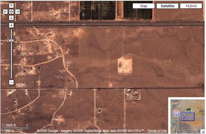
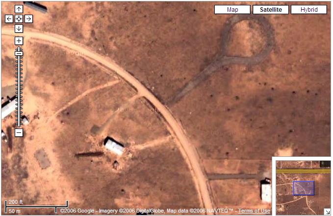
Here is a comparison of images taken by GeoCam (at 36 km up with a Canon Camera) and those taken by Satellites and featured on Google Maps. This is just before entering Moriarty, NM:


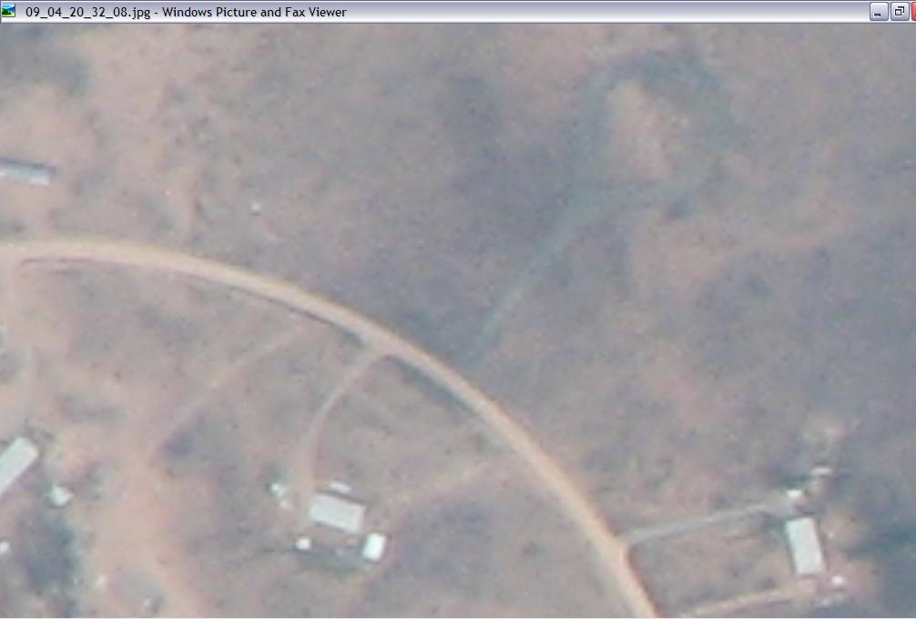
and a frame taken by GeoCam at the same scale

The level of detail afforded by GeoCam is comparable to the next best resolution provided by Google Maps.


Pedro has estimated that one pixel on GeoCam is about 3.3 feet. Potentially, GeoCam could be provide coverage for a larger swath of land as, in this flight it was tilted at 20 degrees angle from Nadir.


More on that later.

Saturday, September 30, 2006

Being Slashdotted.

Welcome Slashdot. For those of you who are interested in following up on what we are going to do with the data (google maps, Earth, video, high definition desktop background, torrents,...), our RSS feed is at http://hasp-geocam.blogspot.com/atom.xml
We will be responding and expand on the comments of the previous entry on panoramic views in the upcoming days.

Panoramic views

[Slashdot readers]

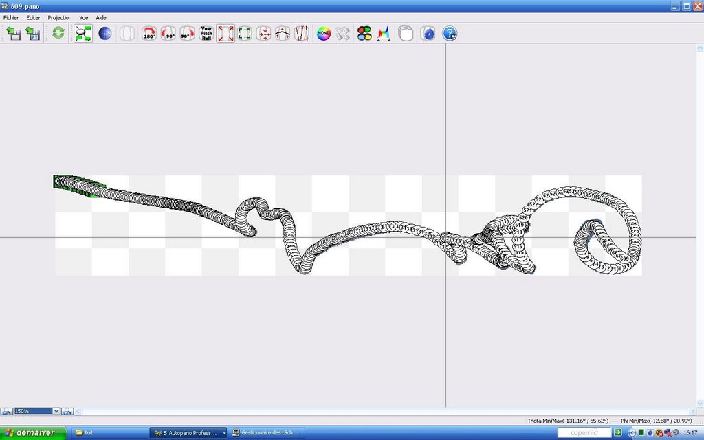
An interesting use of the data from GeoCam is to see how stitching algorithms are performing with data from our balloon flight. An algorithm developed by Matthew Brown does this automatically through the comparison of SIFT points and a RANSAC algorithm determining good fit. The software is available at the AutoStitch web page.

We first tried stitching five photos together and obtained a reduced file (200 KB as opposed to 5 times 3.2 MB)


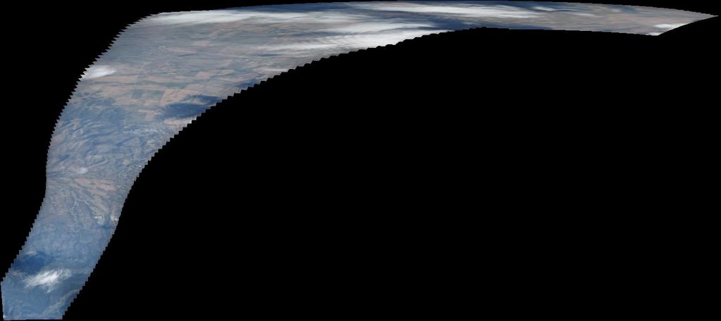
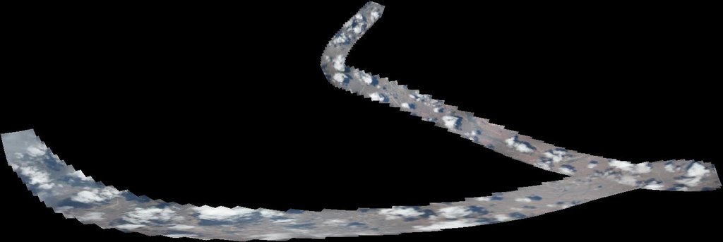
We then went on using about 100-200 frames per panoramas and obtained the following views:


It seems evident that the payload wasn't turning at 1 rpm.


One of the apparent issues seems to be that the comparison for overlap between frames was based on cues from the clouds. Since we took photos at intervals of about 23 seconds, some of these clouds changed location and eventually allowed for some of the panoramas to be unduly stretched.

Thursday, September 28, 2006

Panoramic views - Preliminary results

An interesting use of the data from GeoCam is to see how stitching algorithms are performing with data from our balloon flight. An algorithm developed by Matthew Brown does this automatically through the comparison of SIFT points and a RANSAC algorithm determining good fit. The software is available at the AutoStitch web page.

We first tried stitching five photos together and obtained a reduced file (200 KB as opposed to 5 times 3.2 MB)


We then went on using about 100-200 frames per panoramas and obtained the following views:


It seems evident that the payload wasn't turning at 1 rpm.


One of the apparent issues seems to be that the comparison for overlap between frames was based on cues from the clouds. Since we took photos at intervals of about 23 seconds, some of these clouds changed location and eventually allowed for some of the panoramas to be unduly stretched.

Thursday, September 21, 2006

WOW


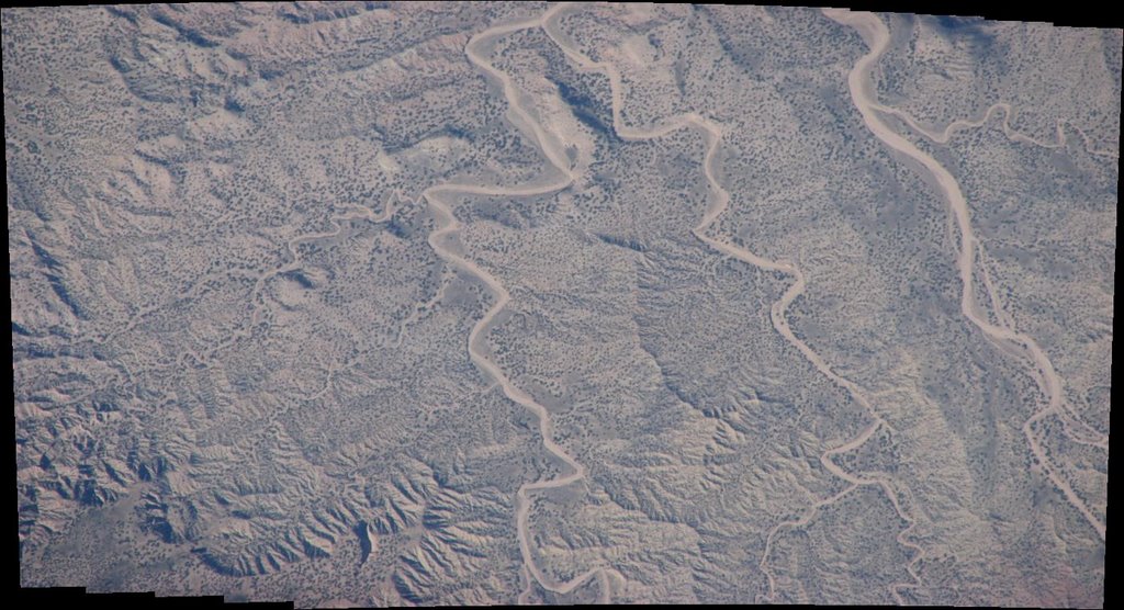
Pam and John opened the camera an hour ago and found 1650 images. This is mission success. Each image is about 3.7 MB. We are beginning to work on implementing an interface so that it can be browsable to the rest of the world. The image of this entry is one of these shots taken by GeoCam.

Wednesday, September 20, 2006

NASA Balloon Carries High Altitude Student Platform to the Edge of Space

NASA just came out with a press release on the whole HASP program, take a look at it here.
After reading about this story on Slashdot, I noticed in the comment section that last year, some other team did something similar to our project but it looks like their camera froze on the way up. Our current expectation is that the camera might have gotten very warm once it reached 120,000 feet. We'll see when the payload arrives home. A related effort at NOAA is similarly interesting. We believe that the main difference between all these payloads and ours is our stated goal of making a mapping of these pictures onto real maps (google maps). Our camera was specifically focused to get the most detail out of the landscape whereas most of the helium balloon shots seem to have looked at the wider angle to get shots of "space".

Tuesday, September 12, 2006

Coming home


The crates should have been picked up at Ft. Sumner today and we expect to see them at LSU later this week.