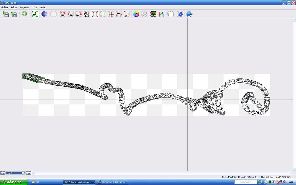
This is what the large panorama looks like. When you create it as a PSB file (Photoshop) using the latest version of Autopano Pro, it is about 51 GB large. It is taking time for us to open it and save it in a format that is viewable on the web (Zoomify).
Thursday, December 21, 2006
New Mexican View
Hyper-GeoCam
We just sent a proposal to LSU to fly on the second HASP flight with a modification of the current camera. We are now aiming to build a cheap hyperspectral imager.
Orders of Magnitude Resolution Estimation for Digital Cameras at High Altitude
One of the reason for our successful flight is linked to the quality of our photographs. When flying at 36 km altitude, we are roughly at one tenth the altitude of either the International Space Station (ISS) or imaging satellites. For cameras similar to ours, shots taken from the ISS have therefore 10 times less the resolution. Case in point, the LUECKE sign near Bastrop, TX. This sign was used by NASA to evaluate the resolution of astronaut acquired photographs from the ISS.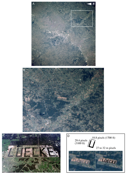
Calculations show an equivalent of 27 to 32 m for a pixel. The same sign can be seen on Google Maps here. Our previous comparison with Google Maps shows a 1 m resolution for a pixel or imagery details like this one.
Wednesday, December 20, 2006
Sites and Projects we like

* The Global Connection Project: a project with CMU, Google and NASA Ames aimed at using a panorama approach to stiching photos together to produce imagery in case of natural disasters. This is pretty much our approach. They started before us but we just stumbled on their site recently.
* the Multi motif Stratospheric experiment: A team of swedish students who will be performing an experiment similar to ours. But they also have access to a rocket.
* StratoCat: a comprehensive and up-to-date site on high altitude balloons worldwide.
* Post storm imagery from the NOAA. Look out! the whole database of images is about 10 GB.
* Astronaut acquired photographs.
* Another experiment called GeoCam that flew a set of cameras on board the Space Shuttle in 1993.
* NOAA Balloon flights.
* Kite Aerial Photography.
* CU Spaceflight balloons.
Wednesday, December 13, 2006
Off to Louisiana

Some of us will be attending a UAV workshop for disaster monitoring and present a poster of our work doing panoramas. The presentation is available here. We will also send a proposal for the next HASP flight before the end of the week.
Subscribe to:
Posts (Atom)
