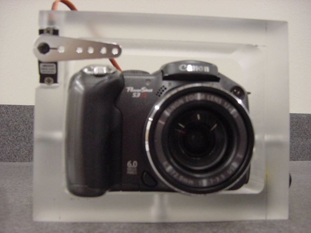
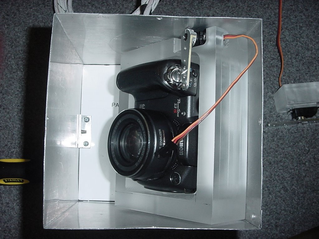
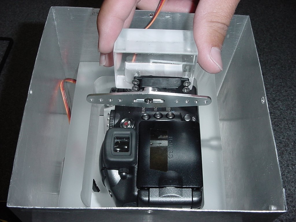
This is what GeoCam looks like:


Any questions ?
We are less than a week before integration of our payload at LSU and we are making some progress in the building of the frame and some of the automated parts of the payload. Case in point: the clicker (watch it click here)
- The mechanical finger has been mounted to the bracket and tested today. It works great.
Monday is the day the whole camera bracket should be finished. The attachment of wires from the servo to the bracket for the swivel mechanism and mounting are our last big structure tasks.
- There was a video taken of the camera taking pictures using the mechanical finger, it will eventually be available.
-The program for the servos does work. The timing of the servos to work together is okay but the actual time intervals have not been entered into the program.
-The circuit board for the servos has been completed.
-The power converters were tested today to insure they were delivering the correct voltages. Half of the voltage was being delivered because the resistors we used were equivalent to the internal resistance of the camera. By using smaller resistors the desired voltages were obtained.
-A heat reflective, thermal blanket was purchased and will be used to insulate the camera when we test the temperatures again.
Recent completions
-In addition to the half of the aluminum box, the bracket for the camera has been fabricated. A thick chunk of clear plastic was used to create the bracket because of its strength and resistance to breakage. All of our components must be able to withstand the approximately 10g's they will experience when the balloon parachute deploys. Not all of the corresponding holes for attaching the bracket to the box have been drilled. One hole has been drilled on the bottom side of the bracket to aid in mounting the camera for testing. The cut out for the servo that acts as the mechanical finger has also been completed. The servo must be mounted to the bracket so that it moves with the camera.
-A program has been compiled to synchronized the servos using the microprocessor.
-Testing of the camera has revealed the normal temperature increase of various parts of the camera body while sitting in room temperature conditions. From those tests we have concluded that the camera will most likely turn off because it is not producing enough heat to keep the internal temperature in the operating range. More tests with the finished housing and insulation will be performed in a controlled chamber. With the use of the chamber will be attempting to simulating the atmospheric temperatures that the box will experience once it has been launched.
The project has been subdivided into different tasks.
Summaries of the tasks so far:
Design and fabrication of the GeoCam housing - GeoCam will be attached to a bracket, which will be mounted to a rectangular aluminum box. So far, half of the aluminum box has been fabricated.
Preparation for integration of GeoCam with the HASP balloon in Louisiana - A checklist of tests we need perform must be created to insure that GeoCam is working properly once it has been integrated
Servo Controls - Two servos are being programed for use: the program for one of the servos has been finished and is going rotate the camera during the flight, the second is going to serve as a mechanical finger to push the button on the camera to take pictures. The GeoCam camera can take a set number of up to 10 pictures continuously. The button on the camera must be pushed for each set of pictures, which is the purpose of the second servo.
Power Connection - The power supplied being delivered from the balloon is more than we need for our components so it had to be stepped down to the desired voltages. This was not a huge problem for our servos but the 7.4 V camera posed a challenge.
Design and implementation of the swinging element - The camera will rotated back and forth at timed intervals to insure that the images taken will not be duplicates. The rotation will be controlled by a servo that is programmed to rotate at the set interval. The arms will have some type of stiff wiring running from the servo arm to the camera. When the servo arm rotates it will push or pull on the camera, thus swinging the camera.
Design and implementation of a clicker - We need a mechanical finger to trigger the image taking process while the camera is in flight. Our solution was to have a metal piece connected to the arm of a servo. When the arm rotates the metal piece presses the button on the camera.
Design thermal insulation for the camera - There are temperature constraints with our camera; it has a functioning range of 0-40 degrees Celcius. The temperatures that GeoCam will encounter while be lower than the operating temperature. That means that we will probably need sometime of insulation to keep the camera from shutting off.
Programming the microprocessor and integrating the electrical components - The actual microprocessor is what is being programmed to control the two servos. The compiler we were using only allowed a certain number of lines in the programming. The limited amount of lines made it difficult to program the servos to be synchronized. All of the power and electrical components have to be connected onto one circuit board.
Design and implement a data processing capability to display information from HASP into google maps - One of our most difficult challenges will be processing the images from the camera so that they can be used in correspondence with google maps. GPS technology located in the balloon's paylod will aid in the superimposing of the images onto current maps.
The people involved in the GeoCam's development can be found here. It is a group of Texas A&M University students working at the Student Engineering Institute with supporting staff from the Spacecraft Technology Center.
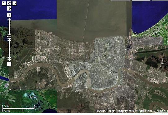
In disasters of enormous proportion such as Hurricane Katrina, the Asian Tsunami or the recent Pakistani earthquake large swath of terrains were suddenly rendered inaccessible or impossible to image. Satellite access time to these areas meant not having access to imagery for periods of time ranging from hours to days. The delay in access time to imagery is critical at the level of first time responders but increasingly it is becoming obvious that the general population want similar information.
High altitude balloons can be deployed in a matter of hours and provide emergency remote sensing thereby enabling first responder's situational awareness and give adequate trajectories to rescuers. It would also enable the diffusion of imagery to a large segment of the population looking for information thereby reducing the strain on the telecommunication system of the affected area.
With these requirements in mind, we propose to use a low cost Off the Shelf digital camera (COTS) called GEOCam to provide high resolution imagery from high altitude balloons in order to provide geographical information on large areas of interest. Superresolution of images taken by COTS cameras can be obtained through the use of proper image processing of series of frames. We also propose to evaluate the ability to perform photogrammetry in order to estimate 3-d information from a series of frames.
Our outreach plan consists in providing trajectory of the balloon on a Google Maps and Google Earth interface. The result of the diverse image processing performed on the movies and still frames of the HASP campaign will also be featured on the same website. The project will make available how we built the hardware in order to provide this capability to people affected by disasters. The data stream going from the camera all the way to how it was implement as overlays on Google Maps will also be explained in detail.
Our application for the HASP program has been accepted. More on this here.
The main difference between a project like ours and others where cameras are flown on UAVs is the ability to image large swath of lands. At 120,000 feet, the ability to cover the whole city of New Orleans becomes a matter of steering the camera rather than an issue of craft navigation. We also expect that the impedance between the world's expectation of instantaneous news and the filtered first responders information stream will only get bigger. Solution like ours would prevent this bottleneck of information thereby providing everyone (including first responders) will clear and valuable information.


